Home Home

CCAMLR

Commission for the Conservation of Antarctic Marine Living Resources

  • Home
  • Skip to Content
  • Log in

Search form

  • About CCAMLR
  • Conservation measures
  • Science
  • Fisheries
  • Compliance
  • Data
  • Meetings
  • Publications
  • Circulars
  • English
  • Français
  • Русский
  • Español
  • Home
  • Area 88
Print this page
Increase font size
Decrease font size

Area 88

Short Label: 
88
Long Label: 
88
Description: 
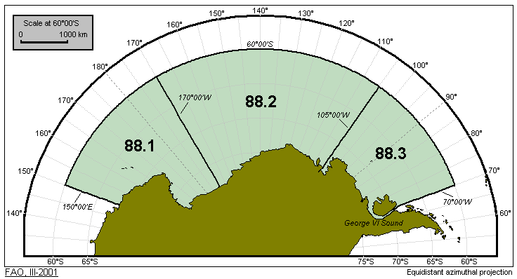
All marine waters of the Antarctic Pacific bounded by a line commencing from a point on the coast of Antarctica between Oates Land and George V Land at 150°00'E longitude thence due north to 60°00'S latitude; thence running due east along this parallel to 70°00'W longitude; thence due south to a point at 70°00'W longitude on the northern coast of Alexander Island; thence along the east coast of the island to a point on the south coast at 70°00'W longitude; thence across the George VI Sound to a point at 70°00'W longitude on the coast of Antarctica at Palmer Land; thence due west along the coast of Antarctica to the point of departure.
Map Image: 
This page was last modified on 15 Sep 2015

Contact us

Email: ccamlr [at] ccamlr [dot] org
Telephone: +61 3 6210 1111
Fax: +61 3 6224 8744
Address: 181 Macquarie Street, Hobart, 7000, Tasmania, Australia
Postal address: PO Box 213, North Hobart 7002, Tasmania, Australia


Quick Links

  • Job vacancies
  • Schedule of Conservation Measures in Force 2021/22
  • Statistical Bulletin
  • CCAMLR Brochure

Recent and Upcoming Meetings

  • Log in
  • CCAMLR e-groups
  • Support
  • Copyright
  • Disclaimer and Privacy Policy
  • Sitemap
  • Intranet
  • Webmail
© Copyright - the Commission for the Conservation of Antarctic Marine Living Resources 2025, All rights reserved.  |  Top of page  |  Site by Eighty Options