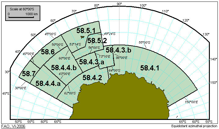
Short Label:
58
Long Label:
58
Description:
All marine waters of the Antarctic and Southern Indian Ocean bounded by a line commencing from a point at longitude 30°00'E on Princess Ragnhild coast in Antarctica; thence due north to 45°00'S latitude; thence due east to 80°00'E longitude; thence due south to 55°00'S latitude; thence running due east along this parallel to 150°00'E longitude; thence due south to the coast of Antarctica between Oates Land and George V Land; thence running in a westerly direction along the coast of Antarctica to the point of departure.
Map Image: